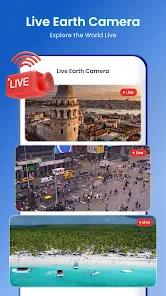
The application is a versatile geospatial utility designed to bridge the gap between traditional navigation and high-definition virtual exploration. Functionally, it integrates real-time satellite imagery with a suite of "Swiss Army Knife" tools, including a "Satellite Finder," "Area Measurement," "Speedometer," and "Meet In Middle" features. The application’s architecture is built around 360-degree panoramic cameras and "Live Earth Cams," which provide real-time video streams of nature, beaches, and street scenes globally.
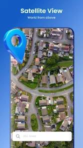
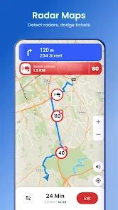
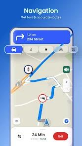
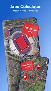
Deep functional disassembly reveals four primary map styles: Normal, Traffic, Satellite, and Terrain. Strategic insight suggests that the app targets "digital tourists" and professional land surveyors. The "Area Measurement" tool and "GPS Camera" (which adds timestamps and location metadata to photos) cater to professional field-work, while the "3D Satellite Earth Exploration" is marketed toward students and travelers.
However, the application faces a significant "Trust and Quality" challenge. Technical audits indicate that while the imagery is high-definition, the user interface is often described as "outdated by 5 years". Furthermore, the app’s data-sharing policy is a concern for privacy-conscious users, as it shares device IDs and location data with third parties while offering no mechanism for data deletion.
Pros
Immersive Virtual Exploration: The integration of live webcams from around the world allows users to witness events as they unfold in real-time.
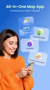
Versatile Tool Integration: Bundles niche utilities like "Area Measurement" and "Currency Converters" into a single interface, reducing app clutter.
High-Resolution 360° Panoramas: The "Street View" function provides a highly detailed ground-level perspective, ideal for travel planning.
Historical Data Access: Users can explore past satellite imagery to track environmental changes or urban development over time.
Educational Utility: Provides basic facts about 650+ countries and regions, making it a valuable resource for students and researchers.
Cons
Opaque Data Privacy: Current disclosures indicate the app collects and shares location data with third parties without offering a deletion option.
Outdated UI Framework: The design is frequently criticized for being clunky and reminiscent of older mobile OS eras.
High Ad Friction: Many of the "free" tools are locked behind mandatory video advertisements, hindering quick utility use.
FAQs
While some "Earth Cams" are live video, the general satellite map imagery is updated periodically and is not a continuous 24/7 feed of your house.
Yes, the "Area Measurement" tool is designed for calculating land plots, though it should be verified against professional survey equipment.
Use the "My Parking" module within the GPS Tools section to pin your current coordinates and set a return route.
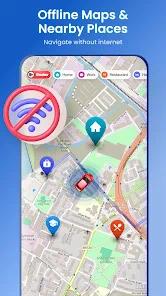
Yes, you can download specific regions for navigation and satellite viewing when you don't have internet access.
These are phone dialing codes for various countries, included in the "Country Info" module for international travelers.
Hot Reviews
While some "Earth Cams" are live video, the general satellite map imagery is updated periodically and is not a continuous 24/7 feed of your house.
Yes, the "Area Measurement" tool is designed for calculating land plots, though it should be verified against professional survey equipment.
Use the "My Parking" module within the GPS Tools section to pin your current coordinates and set a return route.
Yes, you can download specific regions for navigation and satellite viewing when you don't have internet access.
These are phone dialing codes for various countries, included in the "Country Info" module for international travelers.